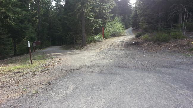
When the snow is gone, this is a easy two point summit not far off of Highway 26 east of Mount Hood.
A bit past milepost 63 and just before Blue Box Pass there is a right turn onto two forest roads - take the right one (pictured). A carefully driven passenger car might be able to navigate this road, but having high clearance would make it easier. And the distances are reasonably short so parking when the road gets too rough and walking a mile or so on a forest road could be an option.
Take this road about 1 mile to a left turn (where we parked due to snow) and follow this road about 0.6 miles to turn west and go up hill cross country about 0.24 miles to the summit. Alternatively, it appears you can continue past the left turn about 0.8 miles and head south about 0.2 miles to the summit. There are lots of stumps for sitting on and smaller trees to support antennas. There's not much you can reach with VHF from this location - we couldn't raise anyone heading by on Highway 26, so an HF activation may be best.
ViewVoting details
Peak 4620, OR | May 2014
Summit:
W7O/CN-090
Voice Cellular Coverage:
Spotty, may not work at all
Data Cellular Coverage:
Spotty, may not work at all
Cellular Provider:
T-Mobile
APRS Coverage:
Full two-way messaging 

