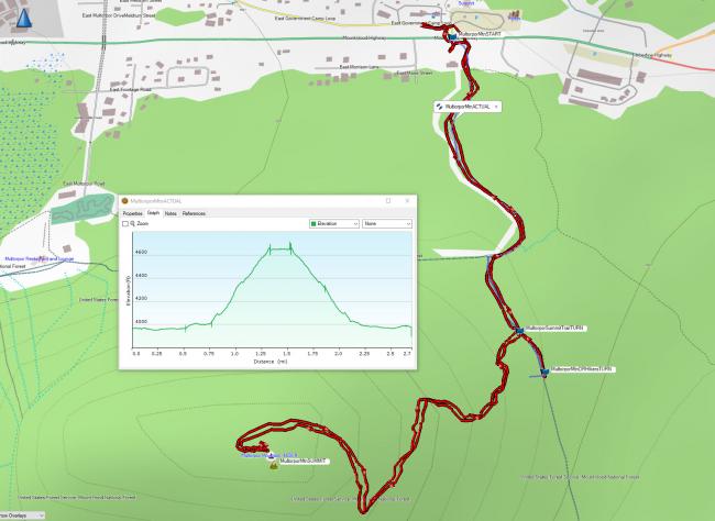
K7ATN provided a good winter access trip report, but there is a very easy trail to the summit of Multorpor mountain that bypasses having to deal with any Ski Bowl access. This activation would be good for new SOTA activators. It is easy to get to and is an easy summit trail under the shade of a forest canopy on the way up. My hike was under 3 miles and under 800 feet of climbing, you could shorten it by parking closer on the road, see below.
I parked at the Government Camp Rest Area, there is a nice bathroom here and ample parking. The issue with doing this is you have to cross Hwy 26 which is a quite busy.
Cross the highway with caution and find the road near 45.30206, -121.74620. Pass a green A-frame equipment shed and follow the jeep track. It looks to me like you could park on this road and spare having to cross Hwy 26, but I don’t know the parking rules here.
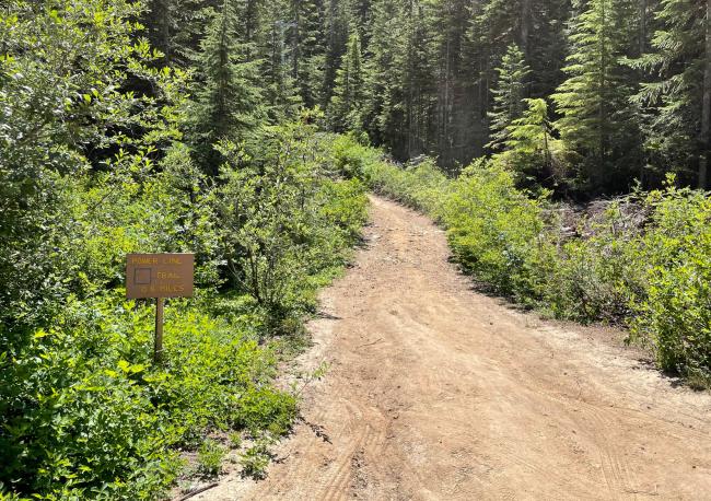
As you follow the road you come to a signed junction with the Powerline Trail (image below). Go left here, heading up on a rough track for about ¼ mile. You could drive to this TH, but again, don't know the parking rules.
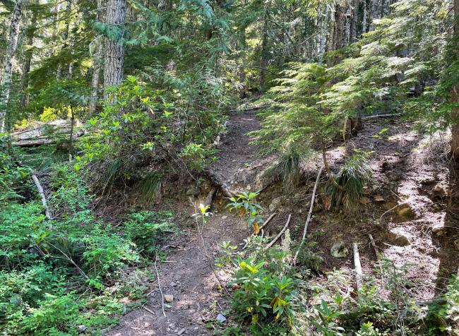
The Oregon Hikers web site said to go over the crest of this trail to get to the summit trail turnoff, but I found the TH before the coordinates specified on that site (see image below). Things change over the years! I turned before the crest, near 45.29566, -121.74479 and snapped a photo of the access which is below, it is not signed.Once you get on this trail, although there is no signage, it is very easy to follow and takes you right up to the summit. In July of 2021, there were some downed trees across the trail, likely from the winter ice event. They are not too much trouble, but you need to go over/under about 10 of them on the way to summit.
I had full bars of 5G on ATT so had no issues getting a spot out. I activated on 2M FM on my 5W HT, getting to Beaverton, Happy Valley and Portland, as well as a mobile operator driving on Hwy 97 in Madras. The summit has a rocky top but it is possible to set up HF. I set up an HF antenna, but had other issues that prevented me from firing up the HF rig, so you'll have to let us know how you did on HF! I posted summit photos on SOTA Atlas website.
UPDATE Dec 2021 - There is also parking at the SnoPark on the south side of Highway 26, across from Timberline Road (by the Highway Maintaince Facility). You can walk west along the highway for an eighth mile to the unmarked road heading to the trail, or there's also a path through the woods and past historic Forest Service Cabins. The turn off from the road to the trail is unsigned and NOT obvious - the GPS coordinates may help as well as Greg's photo below. The road appears to be set aside as a trail/ski route and if you can park along it, it's only near the highway and won't save you many steps.


