The summit of Rock Point is a steep short climb up from either the Paradise Trail #124 or FR-6401. Both the forest road and summit are shaded and would be a good choice for a hot sunny day. In good weather, it could be combined with other peaks nearby W7W/LC-059 Timbered Peak and W7W/LC-064 Sister Rocks. If doing multiple peaks, I would do this one last as it is the most shaded route of the three due to recent fires.
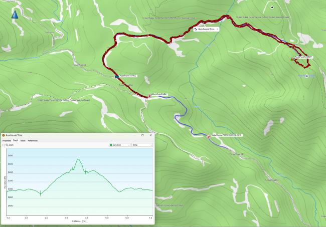
Because of snowy road conditions when I activated, I parked at mile marker 6 on NF-64 (map below). This is the intersection with FR-58 that heads over to the other two summits mentioned above. NF-64 is a "priusable" road, but early in the Spring there may be a good amount of blow down to navigate.
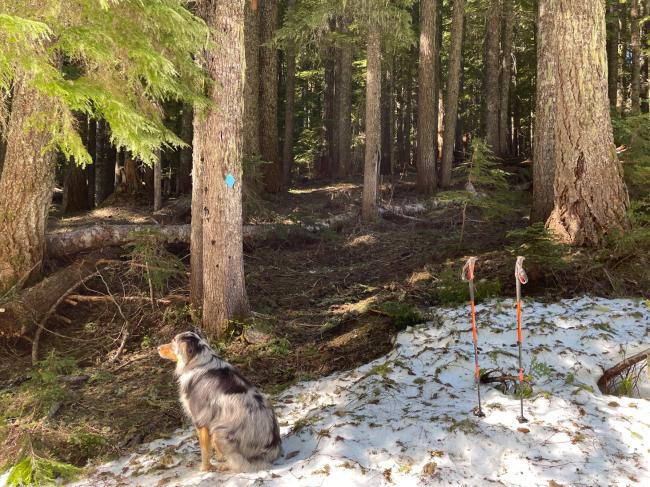
I hiked to the intersection of NF-64 and NF-6401, then up a very pleasant hike on NF-6401 to the intersection of Paradise Trail #124 (https://www.fs.usda.gov/recarea/giffordpinchot/recarea/?recid=31874) near N45.96985° W121.98621°. There is no signage here other than a blue diamond attached to a tree (see image below). Don’t be fooled by turning too soon, there is a forest road that is off to the right just before you cross Trail #124.
The trail traverses below the summit of Rock Point. Due to snow, I left the trail immediately below the summit and headed straight up. I don’t recommend this path. You can do a slightly less nasty-steep ascent by continuing a little further on the trail to around N45.96582° W121.98278° which is a slight saddle to the summit. This was the least amount of "steepness" I could find, then you can take the ridgeline to the summit. This is the way I descended.
My hiking route round trip was 7.25 miles and about 1500 ft vertical. The summit is forested with no views, the activation zone extends some length along a ridge. Summit pictures posted to SOTA Atlas (https://sotl.as/summits/W7W/LC-093
Alternatively, if the conditions support it (there is a gate that is seasonally closed on NF-6401 in winter/early spring) you could drive up to the intersection of Trail #124, or a bit further up the road to about N45.96809° W121.98223° and park there, and then do a shorter hike.


