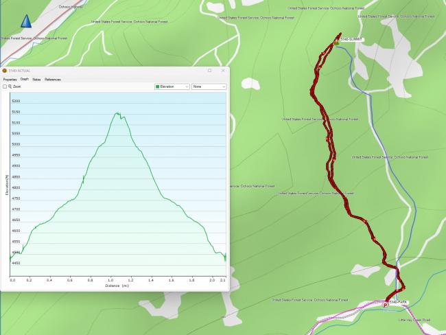
The 5140 summit is a pleasant one mile hike from FR-2610 in the Ochoco National Forest. The turnoff to FR-2610 is right off of Hwy 26 and about 22 miles East of Prineville. I activated in the winter on snow shoes, I found a road bed for the hike up that may allow a near drive up in the summer.
From Prineville, head east on Hwy 26 to about N44.41483° W120.49901° and the signed forest road will be on your right. Proceed up the road approximately 3 miles to N44.42234° W120.44986°. This is where I was able to turn my truck around in the snow and park. The hike is 680 vertical and about 1 mile from this point. In summer you may be able to turn left here and drive up towards the summit.
I had a clear morning for my January hike, but the valley you drive through and where you park can stay very cold. It was 11 degrees for my hike start!
My track in the image below is in red. The blue line was my planned route. I posted summit pics to SOTA Atlas. Trees up top with filtered views. stumps and logs to sit on while activating.


