1.3 mi, +513 feet
This is a super pleasant hike on nice trails. It would also be a great winter activation with skis or snowshoes. There is a very nice enclosed warming hut near the top (within the activation zone) with a wood stove and a picnic table.
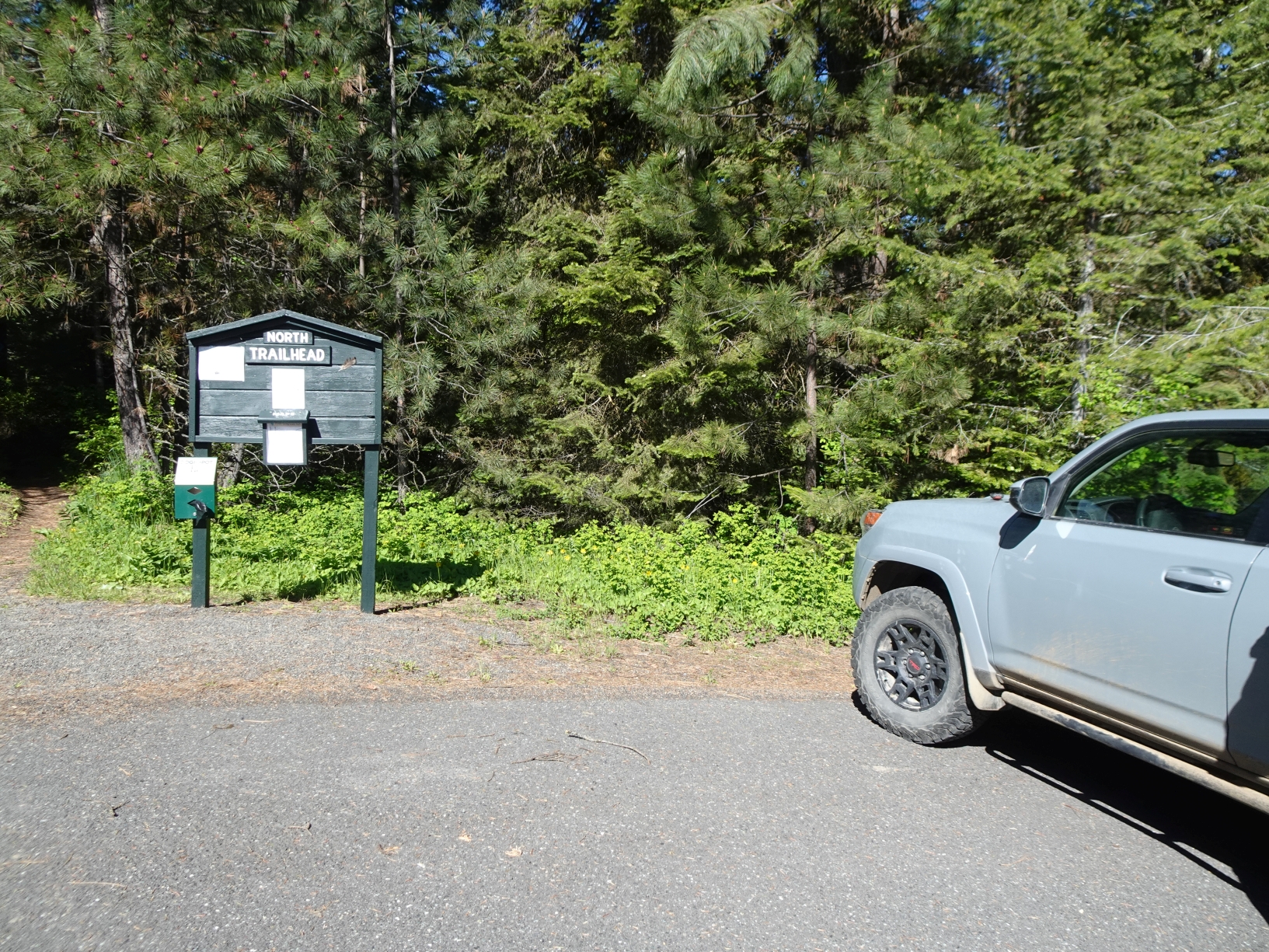
Puffer Butte is the high-point of the Fields Spring State Park. Note that a Washington State Parks “Discover Pass” is needed to park there. While it is best to get the pass in advance, we were able to purchase the pass over the phone from the Park parking lot and write the information (day, Transaction Number, etc.) on a sheet of paper to place on our dashboard. Both the Washington Parks Office and the Ranger said this was OK. You can also purchase the pass at the Fields Spring Office – if the Ranger is there.
We began the hike from the large Parking Lot that is directly south of the Park Office at the "North Trailhead".
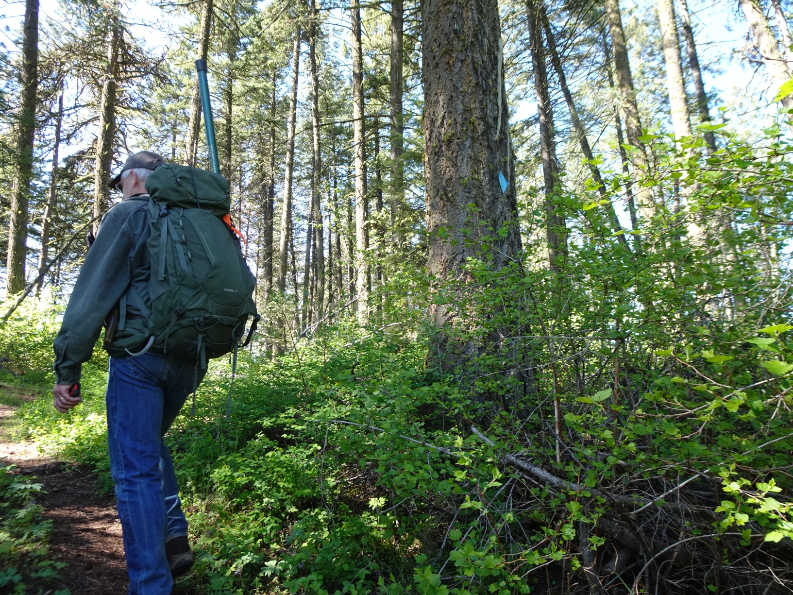
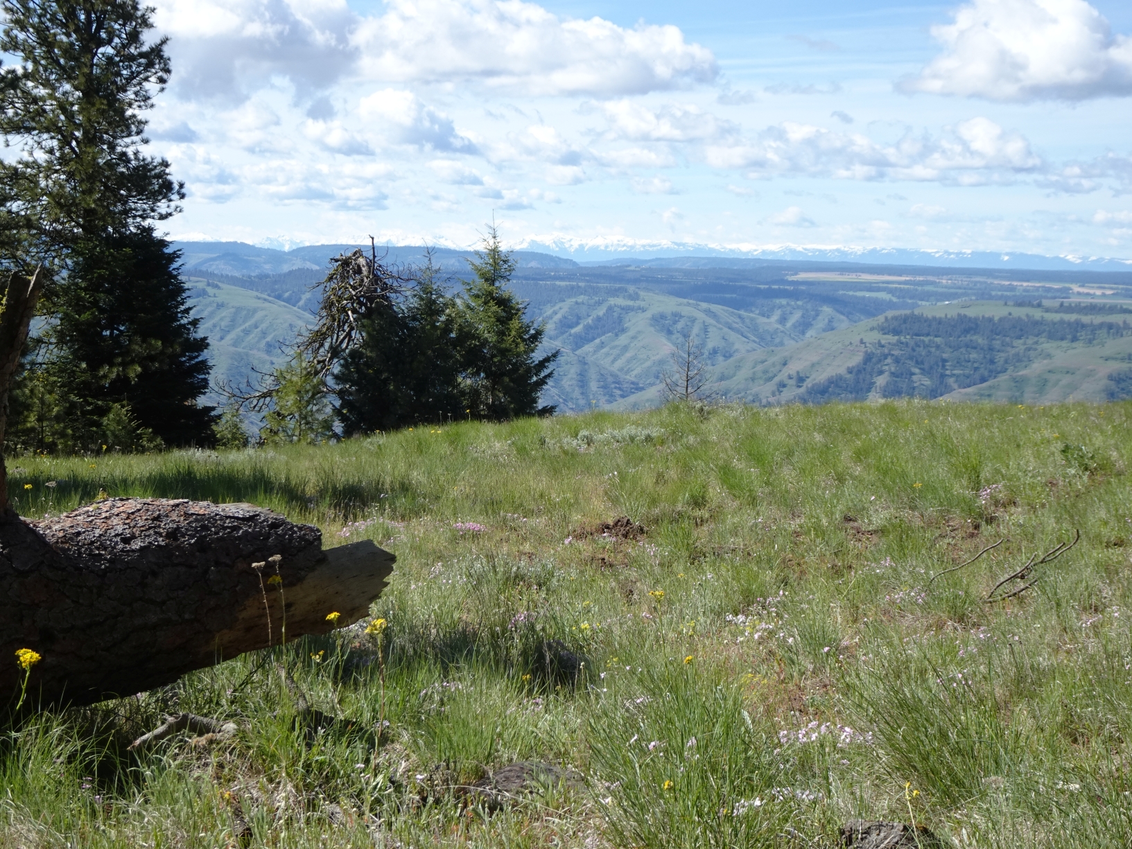
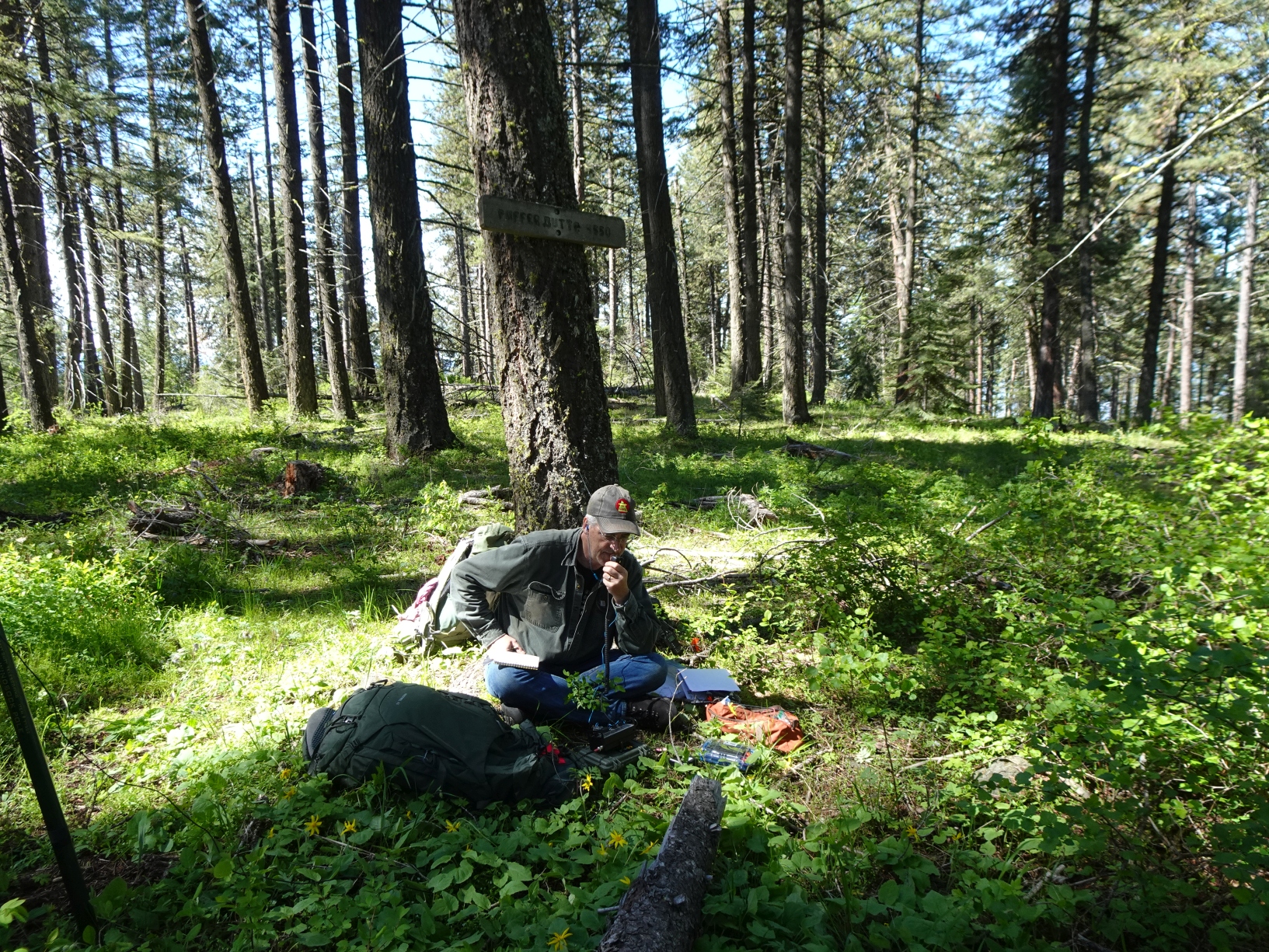
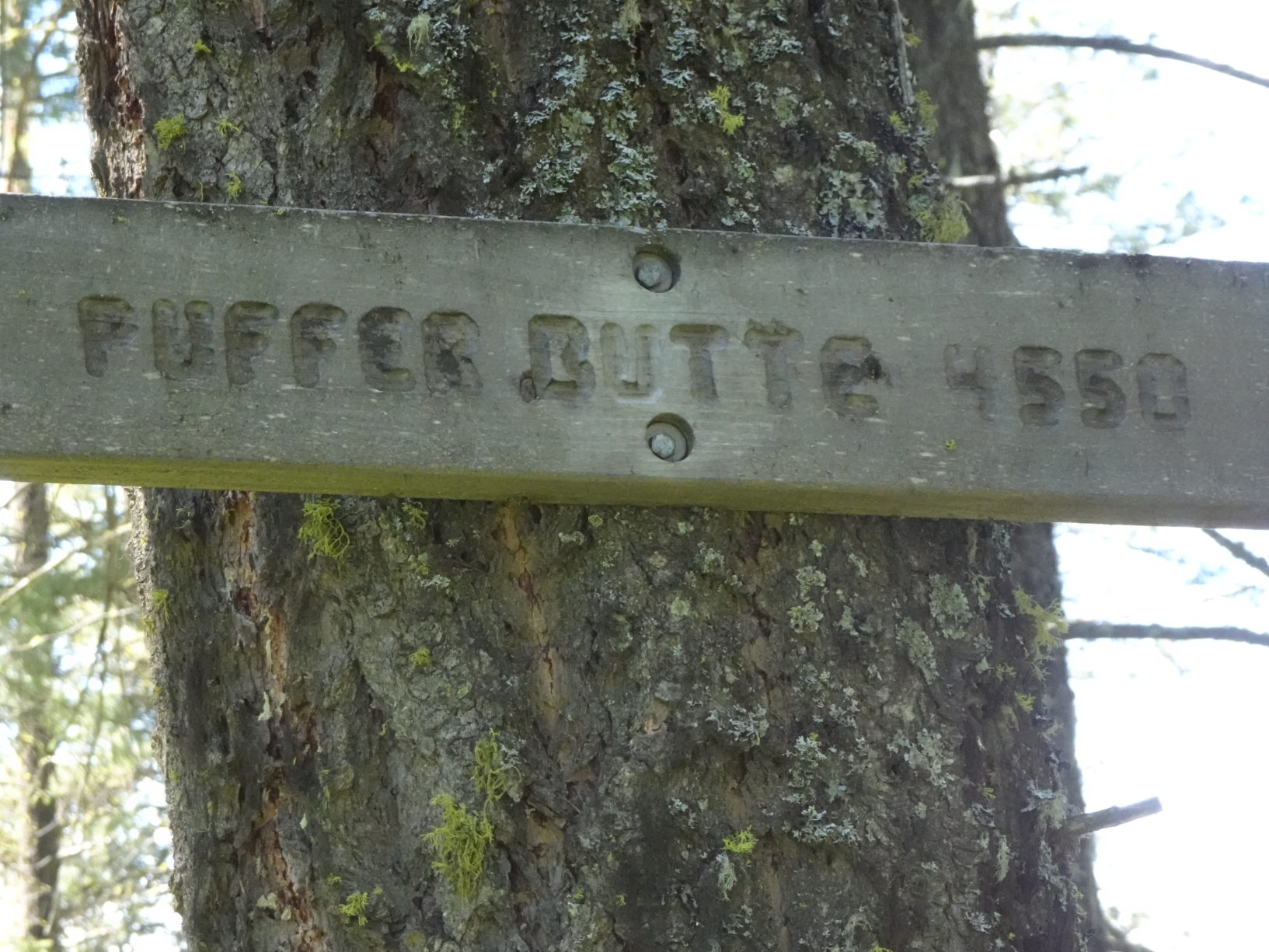
Option-1: This is a nice forest walk up the north side of the Butte. It is also likely the most efficient path to the summit. Park in the large parking lot and hike up the signed trail that leaves from the southwest side of the lot by the large signs. The trail intersects a two-track road at elevation 4,100. Continue straight across the two-track on the footpath. The path will climb at a steady rate before cresting out on the ridge. Once the path crests out, it continues another 0.3 miles before it passes below the summit (the summit will be a short distance west – to your right). While it would be easy enough to go off-trail directly to the summit, we chose to continue a short distance further south to the sign in a large open meadow, then double back to the north to the warming hut, and beyond to the summit (which is a short distance off-trail). There is a wooden “Puffer Butte” sign nailed to a tree at the true summit. Note that the sign in the large open meadow (north of the warming hut) is at the junction between the trail that we ascended up the north side, and an alternate trail on the east side of the butte that descends to the Puffer Butte Lodge. This path is not as heavily forested and has nice views to the east. The foot trails are marked as dotted lines on the Field Springs State Park map.
Option-2: Although we did not do this, the summit can be ascended via the two-track roads on a grade that is likely mild and steady. These would likely be the preferred routes if climbing with skis in the winter. It appears that the optimal winter trailhead may be about 0.5 miles further south than the turnoff to the park offices - just south of the Puffer Butte Lodge. The two-track roads (aka ski trails) are marked as solid lines on the Field Springs State Park map.