The Plan
This year I'm particularly interested in first activations. One of the few remaining unactivated peaks within a couple hours drive from Seattle was Ebey Hill near Arlington, due to the access issues described in this previous pnwSOTA post by WA7JNJ. There are ~20 ascents listed on Peakbagger which describe a variety of forested tresbagging routes which cross the private lands that surround the base of the mountain to get to the public land up top. However, I decided if I was going to claim the first activation on this peak, I needed to ascend it "fully legal".
From looking at the public lands layer in OnX Backcountry, there are 2 spots where public land extends all the way to Jim Creek Road, a public road. One is ~100 yards wide at the SE side of the hill (48.22489, -121.96610) and the other is ~50 yards wide at the SW side of the hill (48.21669, -122.03617).
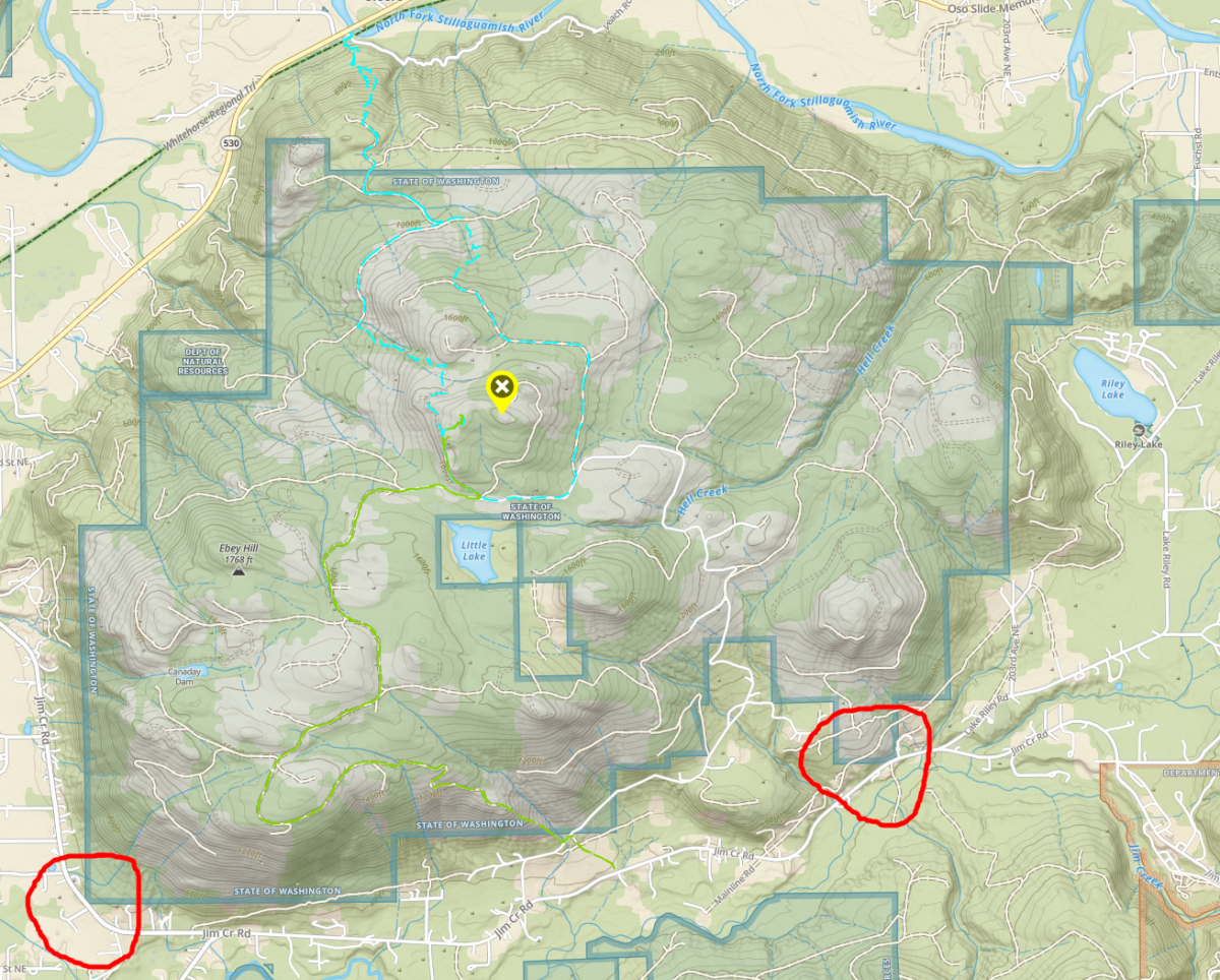
From google street view, neither of them looks to have space on the shoulder to park. However, I could potentially park a few miles up the road and bike to these access spots. I sketched out a possible route for both access points; for the SW access, you could park 2.5 miles away at the Chevron station along 530, and for the SE access you could park 2.1 miles away at the WDFW boat launch at Riley Lake (Discover pass required).
In the end, I chose the Riley Lake/SE access spot over the Chevron/SW access spot:
- biking on a less busy road
- shorter bike segment
- higher starting elevation
- shorter bushwhack segment
- leaving my car for several hours at the lake with a Discover pass felt better than at the gas station
For another recent first activation trip (W7W/SO-099 and SO-100), I was able to "bikewhack" a short section through the woods, then save time the rest of the way to the summit by using my bike on the logging roads (as opposed to walking or running). Since the majority of the distance on this route is also logging roads, my plan for Ebey was to bike from Riley Lake, carry my bike 1/4 mile uphill, then bike the 5ish miles of logging roads to the summit.
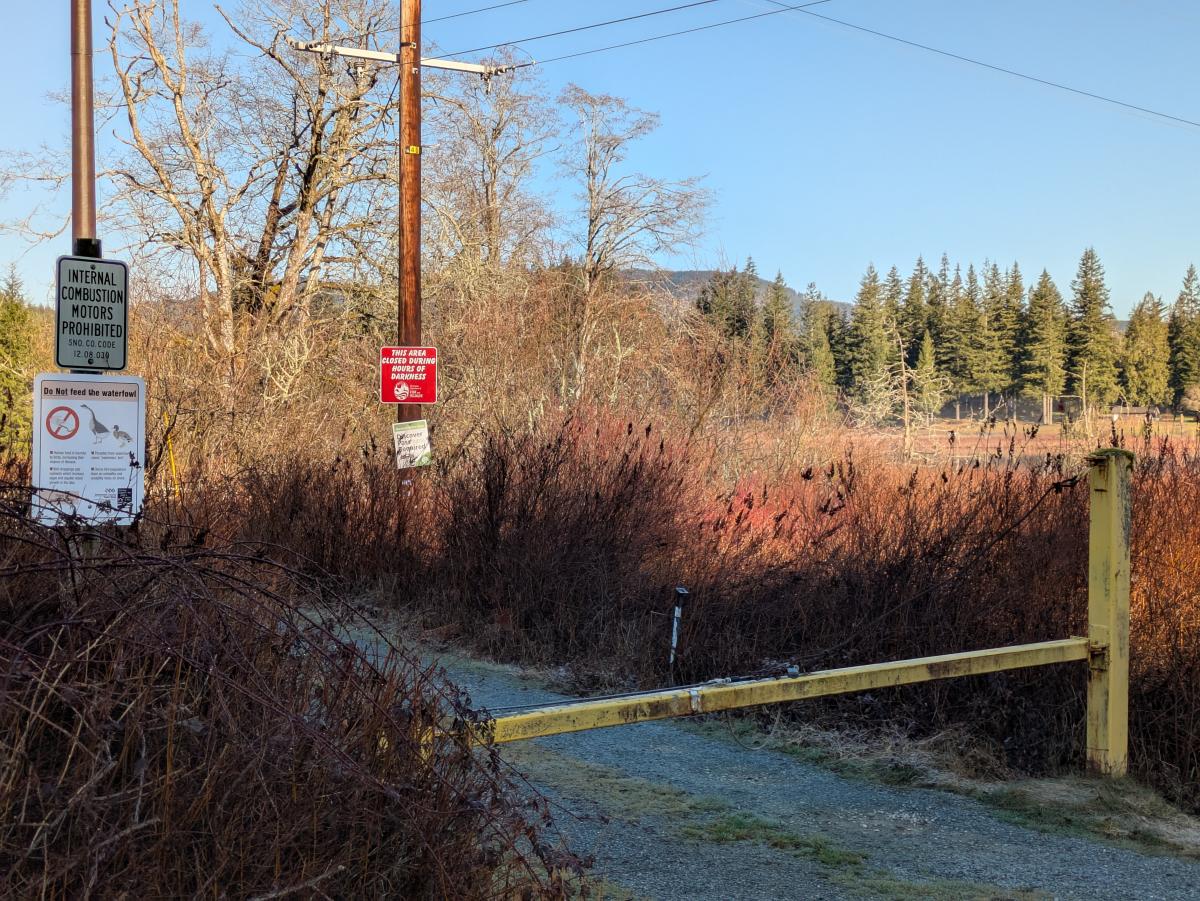
Parking + Approach
The parking area worked well - although the gate to the boat launch and larger parking lot was closed (I was there on March 1st), there was space on the road shoulder in front for several vehicles.
The road approach also went smoothly and only took about 10 minutes on bike.
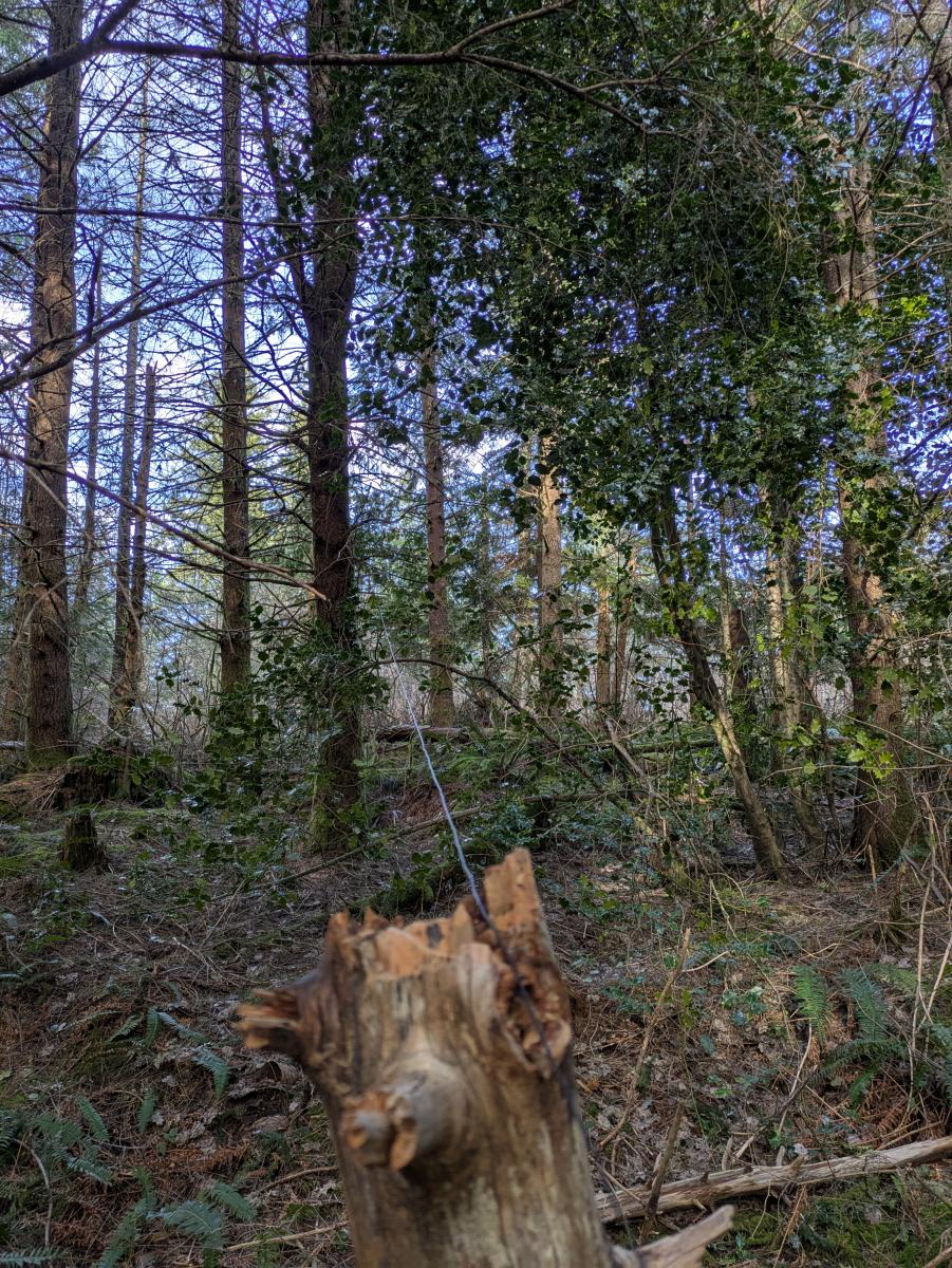
Entry Bushwhack
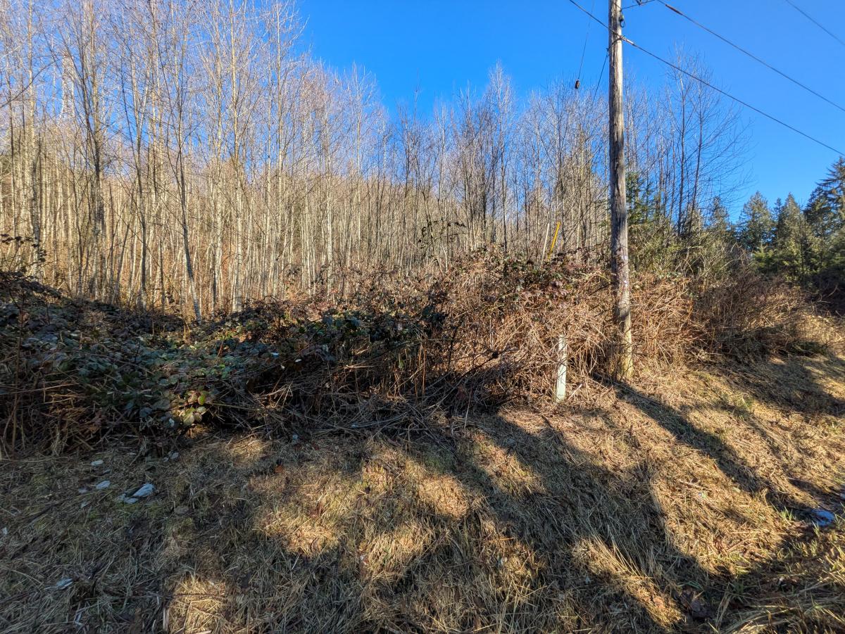
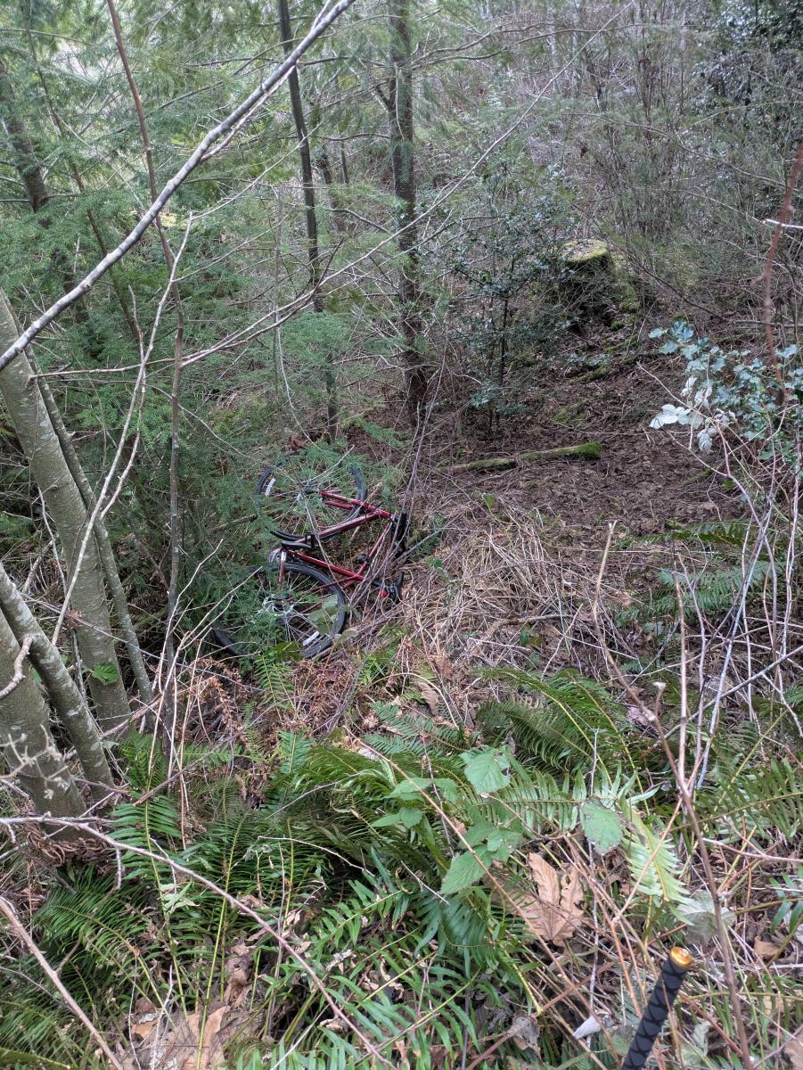
Things went off the rails here. The brush consisted of mostly thick thorn-covered vines that grabbed onto me and the pedals, front gears, back gears, handlebars, etc. It was extremely slow going; it took me about an hour to reach the first power line road and an additional 30 minutes to reach the second power line road and the start of the logging roads. During the latter section, the thorns popped my bike tire, rendering it ineffective for the rest of the day. If you seek to replicate this route, I strongly recommend that you don't carry anything bulky, that you wear thorn protective gear (maybe even safety glasses), and that you still expect it to take a while.
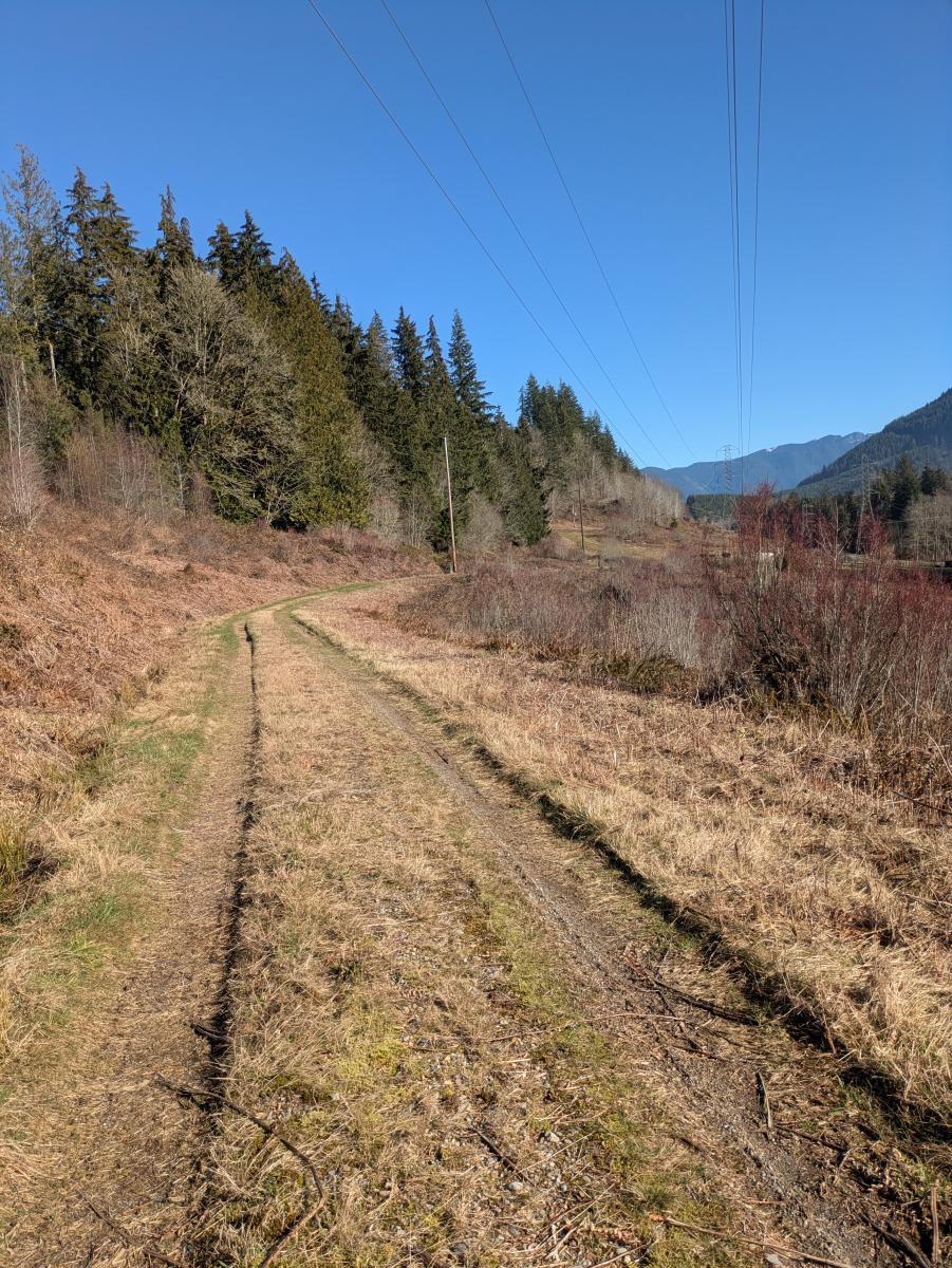
Rest of the Climb
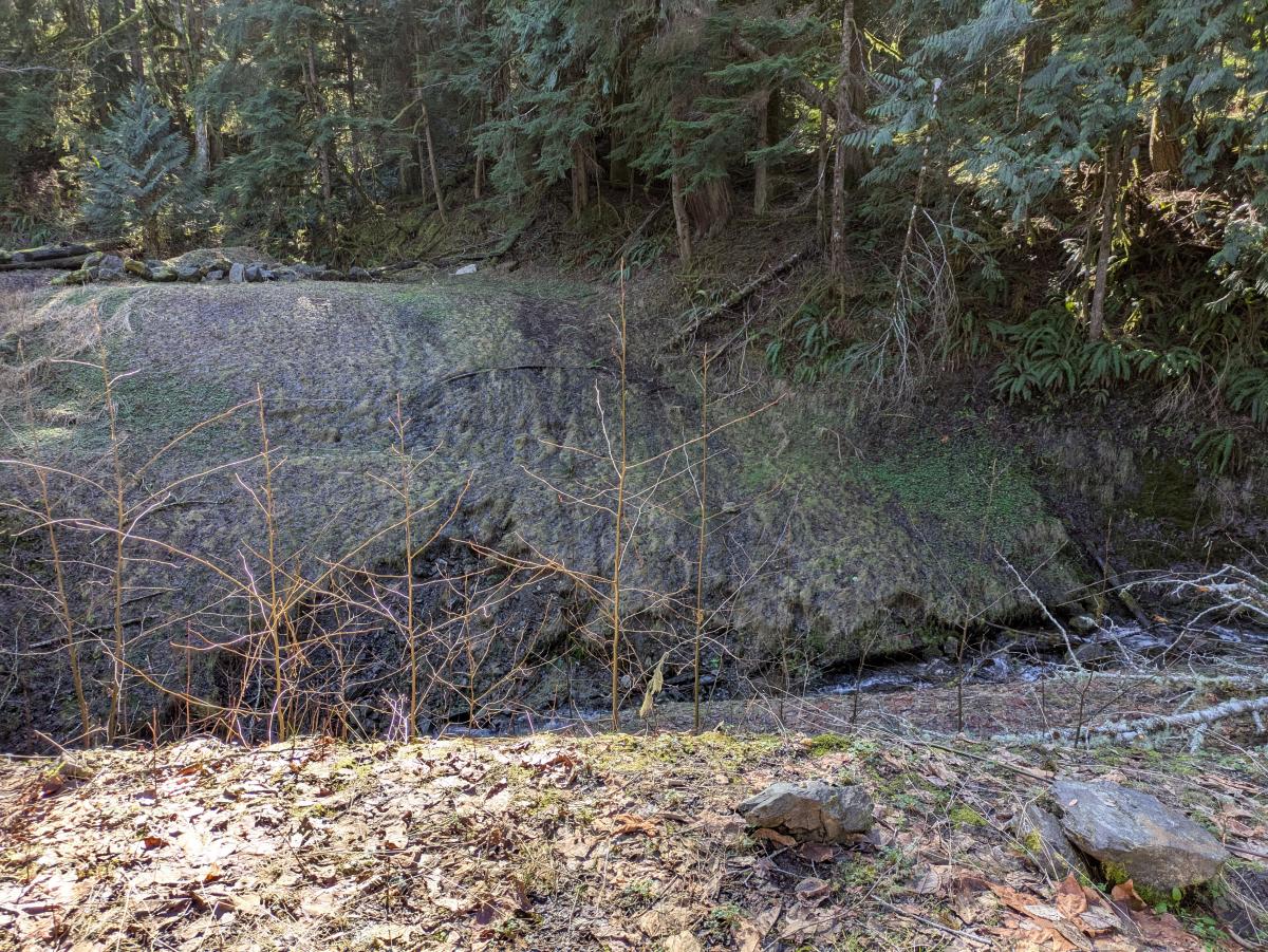
Not to be deterred by my now-useless bike, I ditched it and ran the logging roads to the summit area. The "Forest Practices Application Mapping Tool" (under "Forest Practices") from the WADNR Open Data ArcGIS portal is pretty accurate; the first and last half mile of road on this route is decomissioned, but the rest is nicely graded gravel road. One notable exception is the crossing of Hell Creek, where the road is completely washed out.
There is a short bushwhack at the end to get to the summit proper, but it is much easier/less thorny than the entry bushwhack. There is a shredded white plastic bucket in sight of what felt like the highest spot to me.
QRP Activation
I was actually able to qualify the summit just on VHF (5w handheld into 1/2-wave whip), but I wouldn't recommend putting all your eggs in that basket given how much effort this summit is - I made just enough contacts (4) and most of those were a rough copy. After setting up my EFHW kit in a slightly more open area under some tall trees, I made CW contacts on 40m and 15m using the QMX.
Not-so-QRP
Just up Jim Creek Road is the Jim Creek Naval Radio Station. In contrast to my paltry 5 watts on HF, Jim Creek radiates at 1.2 megawatts on VLF (24.8kHz). From a few spots along this trip I could see the towers on Wheeler Mountain and Blue Mountain that hold the valley-span wires.
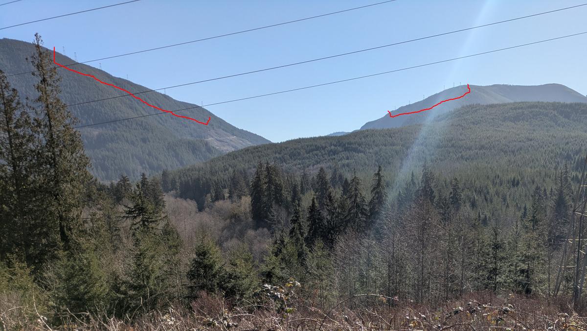
My understanding is there are 2 segments of 5 suspended verticals, each with a very long horizontal wire as a capacitive hat/top-load. The best details I've seen on the system from a ham radio perspective come from this presentation by N4BBB (SK).
Return
Eventually I packed up and mentally prepared myself for the return route. I jogged the logging roads back, grabbed the bike I had ditched, and bushwhacked my way back to Jim Creek Road. It was nearly as bad on the way down, with the exception that gravity was on my side this time. I took to throwing my bike down the hill whenever there was a slight clearing in the thorns. My 2nd tire popped at some point. Eventually I reached the road, ditched my bike temporarily, and ran back to my parking spot. I picked the bike up on the drive out.
Conclusion / Resources
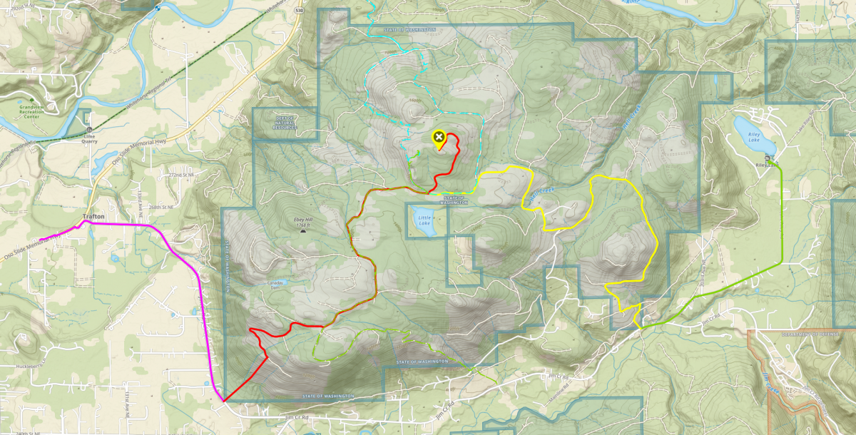
I have made a GPX track of my route available on Peakbagger: https://peakbagger.com/climber/ascent.aspx?aid=2777017
There are 4 tracks within the file:
- Road approach: 2.1 miles, +100'/-150' vert, took me 10 minutes out on bike/20 minutes back on foot
- Entry bushwhack: 0.4 miles, +250' vert, took me 90 minutes carrying bike uphill/45 minutes carrying bike downhill
- Logging road climb: 4.9 miles, +1350'/-350' vert, took me 70 minutes running up/50 minutes running down
- Summit bushwhack: 0.1 miles, +60'/-10' vert, took me 10 minutes up/5 minutes down
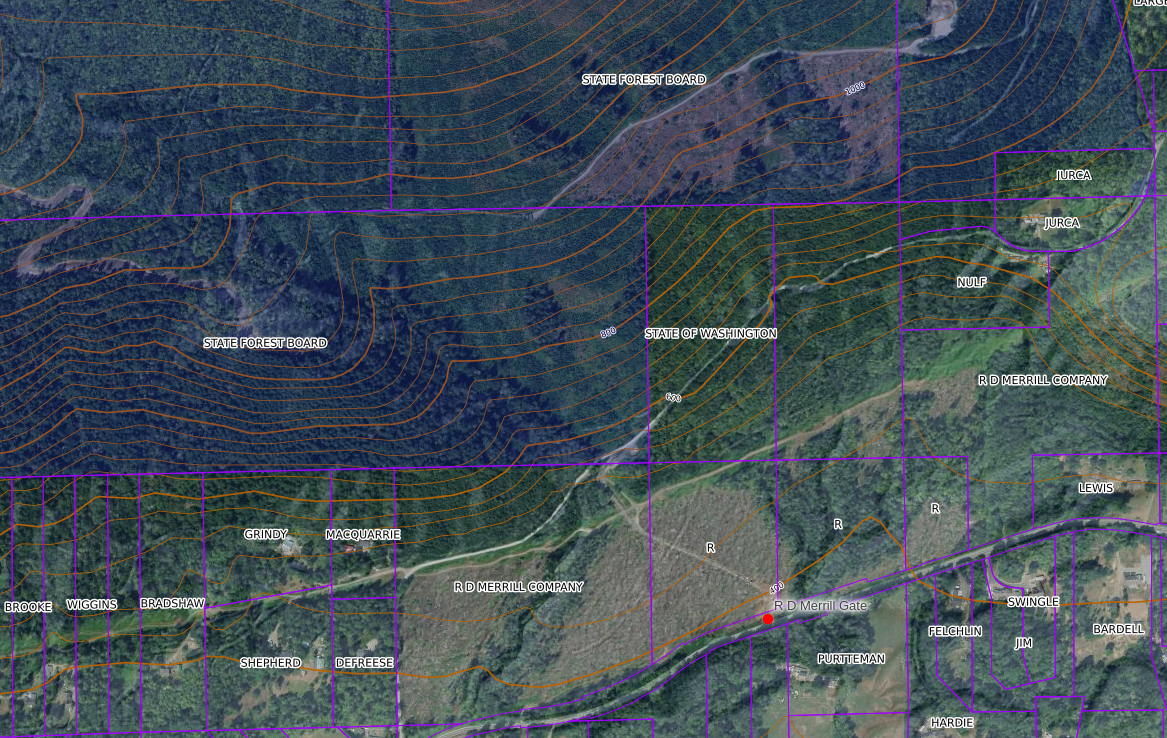
Other routes are probably easier, at least in terms of physical travel. While much of the land around the base of Ebey Hill is owned by private individuals, there are some spots owned by logging companies. In particular, there's a spot at (48.21839, -121.99033) where land owned by "R D Merill Company" has a road (gated) leading to Jim Creek Road. I couldn't find a webpage for this company about their policy for recreational land access, but other people on peakbagger have entered here, so YMMV.