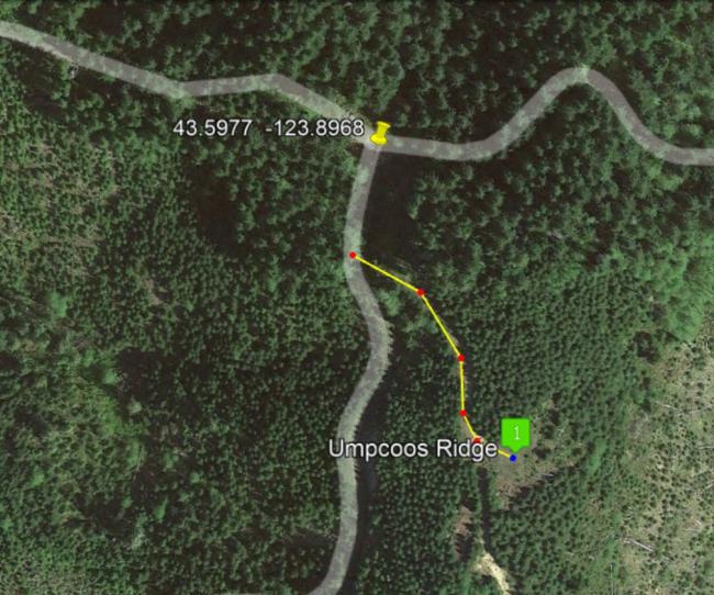
This one-point summit is likely not worth the time driving 40 minutes RT on forest roads. In fact, the roads in this area are quite convoluted - I found it best to navigate using GPS with turn-by-turn directions. You may end up bushwacking through a tangle of coastal brush...or get lucky and find a way to the path visible on sattelite images that I found after the fact. Any "hike" might be less than 0.10 mile and several hundred feet of gain.
From Highway 38 between Cottage Grove and Reedsport, turn south onto Loon Lake Road and go about 5 miles to turn west onto a road labeled Cougar Pass in Google Earth.
Following GPS directions from there, if you park at this intersection: 43.5977, -123.8968. I recommend walking past this point. Take the small road heading south that unfortunately ends up going downhill. However, after only 200 feet, you may find a sub-road in the bushes that I missed...headed off towards the southeast. See the map below. Expect no 2m FM.


