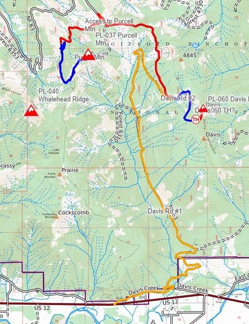
Davis Mtn could be activated with Purcell, W7W/PL-057, via the same access Davis Creek Road. Davis Creek Road goes north from SR12, a few miles east of Randle. Davis Creek Road becomes NF63 which is easily driveable by street vehicles, i.e. "priusable" for about 8 miles. Turn right at 46.58361, -121.81340 onto a high-clearance, at least an AWD, heavily rutted road. Drive about 1.1 miles to a "wide spot" for maybe 3 cars of parking at the base of a west-facing huckleberry field.
Bushwhack up the huckleberry slope to the ridge (about 200 ft of elevation), then follow the ridge north to the summit. Darryl/WW7D recorded a .gpx track which I show in my snip of a CalTopo map attached for both Davis and Purcell. Be mindful that NF47 road to Purcell is washed out for vehicles at 4 mi, or at least, passable via 2-wheeled vehicles.
This area is a huckleberry pickers site. Many "berry trails" up the slope that makes your hike access easier.


