Summary - Sawtooth Mountain, on the north end of Indian Heaven Wilderness, is a 2.5 mile hike with 1000 feet of gain from the parking lot to the edge of the activation zone. This trip report describes getting to the summit, another hundred feet or so up, with unprotected class three and four traverses/climbing and significant exposure. Appropriate experience and gear are a must. If you just want to get to the AZ, a class two scramble on a steep slope, see this trip report. The drive from Portland through Carson and up the Wind River Highway is about two hours and mostly on paved roads, there is good parking, and you will need a NW Discover Pass.
Long Version - Sawtooth was the only Indian Heaven SOTA summit I had not climbed. I originally planned a solo trip but seeing the mountain up close changed my mind, so I recruited Jeff WX7OR and his wife Katrina to join me. The beta on Sawtooth was a bit confusing - some folks called it a class two walkup, others put up ropes - so we packed helmets, harnesses, rope, and pro in addition to our RF gear.
The drive from Portland through Carson, Washington and up the Wind River Highway to NF-24 and the trailhead is paved for all but the last mile or so and takes about two hours. The Sawtooth Trail parking area is located where the PCT crosses NF-24 and you'll need a NW Discover or similar agency pass to park. From the lot, you will see Sawtooth. Take the PCt and at the junction of the PCT and Sawtooth Trail #107, take #107. The hike to Sawtooth rises about 1000 feet over 2.4 miles.
With the rock ridge clearly above you and a visible notch between two rock spires, you will find a boot path leaving the trail and heading up. Here's what it looks like from below:
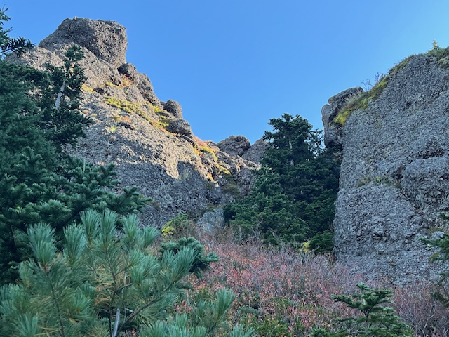
The path up this slope comes and goes. Aim for the notch. It is defniitely class two... a steep, bushwhacking, grab-a-tree-branch ascent. Pro tip: do not climb the notch unless you want to be stuck, lookingly longingly at the summit that you cannot reach, which is what we did. Instead, do what we did after rappelling down. Find the northerly path that along the rock that exits onto a class three, exposed traverse which climbs up to the summit block.
This is the summit block:
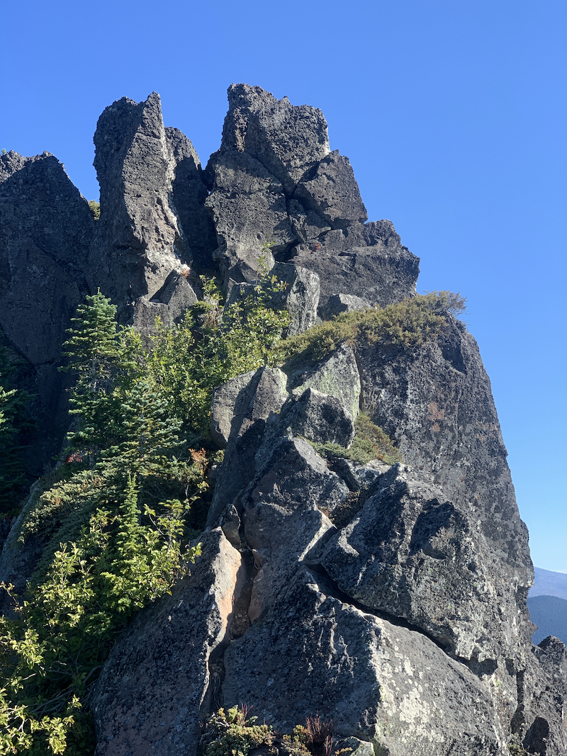
This is a pitch of class four climbing that includes a chimney with some exposure and no good options for protection; we wore helmets but climbed without ropes or pro. The pitch ends on a small flat area with the summit rocks about twenty yards distant. The final pitch is twenty feet or so of class four climbing that is definitely exposed. The pile of conglomerate rock has lots of handholds and a gap (that you will discover behind the big rock in front) that requires confidence in your shoes and your technique. What it looks like:
The summit is large enough for two people but putting up an HF wire would be a challenge. Our time on top was limited, so we worked two meters, got five or six contacts, and called it good. Operating HF from below the summit rock would be easy as long as you had a mast. Remember, you are in the AZ before you reach the traverse, so no need to climb anything out of your comfort zone. You can stop anytime, set up, and have at it. Last caution: going down requires the same attention as going up, maybe just a bit more, don't be sloppy.
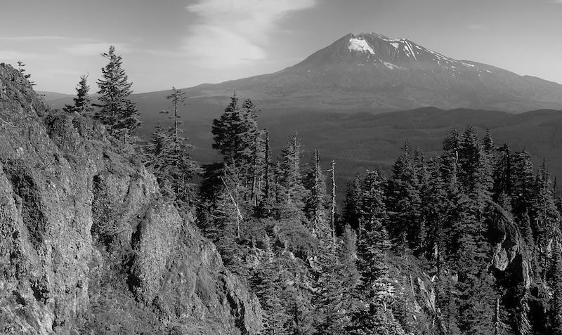
The views were, as expected, spectacluar. Rainier and Baker to the north, Mount Adams to the east, Mount Saint Helens to the west and the other Indian Heaven Peaks lining up with Mount Hood to the south. On a good day, as today was, it would be very easy to hang out up there for hours. Jeff and I agreed that we'd hike and climb this one again and spend more time on the summit.
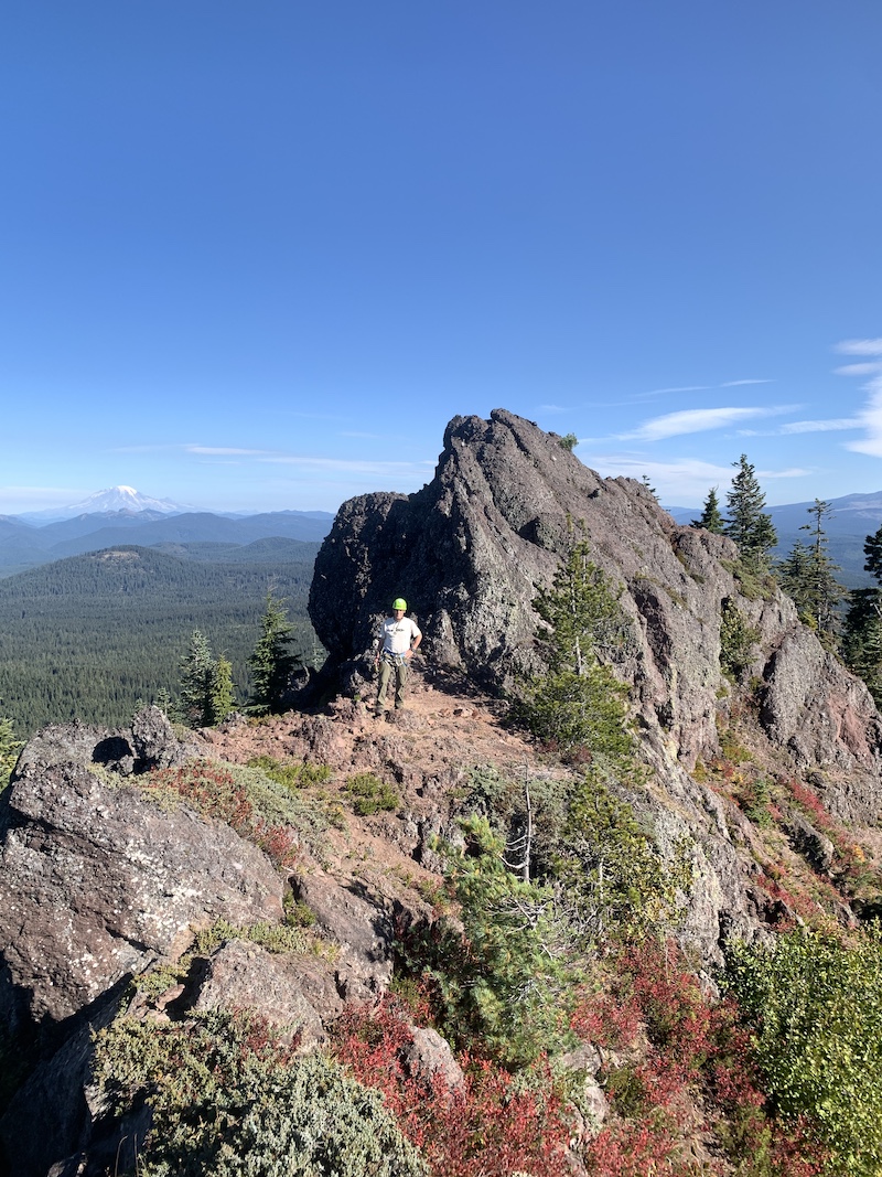
To close out, one view of the summit ridge: