NOTE: The historical trailhead north of the fire station on Salmon la Sac road was closed to public access during 2024. This is an alternative route that can be used when USFS roads are still snow bound.
This write up is not intended to be a complete route description for Hex Mountain. The main purpose is to highlight an alternate way to access the Hex Mountain trail that we believe does not cross private property.
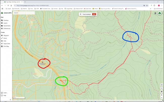
AC7MA and I hiked/bushwhacked an alternate starting route to Hex Mountain on April 4, 2025. We parked at the parking area along the Salmon la Sac Road ,100 yards beyond the Kittitas Co. Fire and Rescue Station No. 78. From there we went behind the fire station and continued on to Forest Service and Nature Conservatory land. See the attached image with parcel data. The red circle indicates the closed trailhead and the green circle indicates the Kittitas Fire Station.
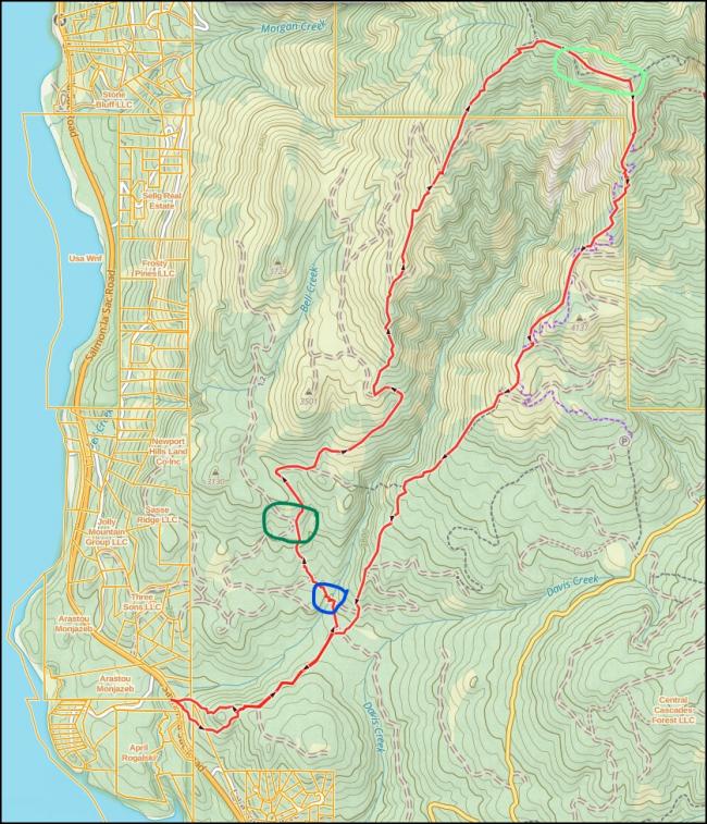
We decided to make the route a clockwise loop and crossed over Newport Creek so that we could join up with the regular trail. The blue circle indicates where we crossed the creek. On the picture that shows our entire loop the dark green circle indicates where we joined up with the regular trail. The light green circle indicates the summit of Hex Mountain. de K7JRO, John O'Brien


