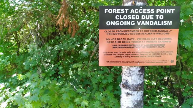
This was once a drive-up activation that has been gated due to valdalism - it is accessable to non-motorized vehicles (see sign below). (Updated August 2023.)
Just west of the Highway 26 Rest Area at Milepost 28, turn south onto an unsigned dirt road. After about 0.3 miles keep left on the main track of Sterling Ranch Road. You'll go 2.7 miles farther on this road, taking a left at a large triangle intersection. This road did not show up on my GPS.
After about 0.5 miles, you'll keep left, and about 0.2 miles farther on, left again. Another 0.3 miles and you'll turn right this time, going a short distance to a Y where you keep left to the end of the road and the summit.
There's a few small trees surrounding the wide spot at the end of the road that is the summit. There doesn't see to be much 2m FM coverage into metro Portland from here - worked just one on that band with the rest on HF.
.


