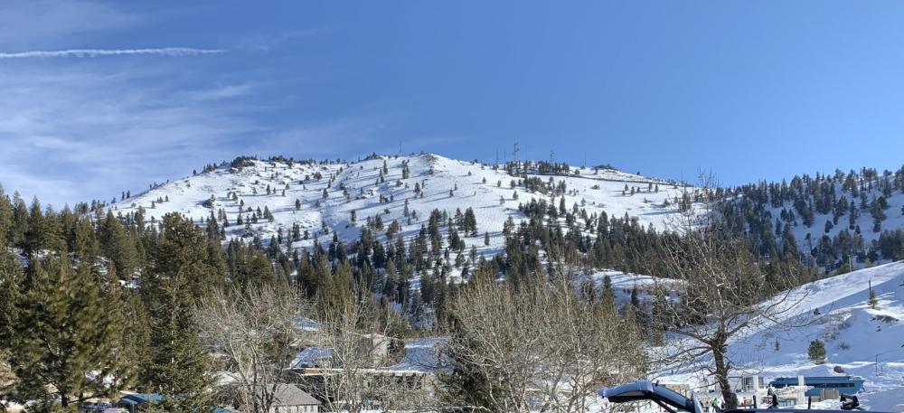
Good Views From Summit

Summit has good "views"

Point Mountain, OR August 2019

Submitted by AG7GP on
Summit

Point Mountain has a pretty good trail most of the way. It is mainly a steep bald mountainside especially for the last  few hundred yards of the climb. I do not recommend short cutting, the brush is too thick where it gets tempting because you are oh-so-close to the top. This is also an area known for bear. My first trip up I got growled at by something in the thicket ?? Turned around and kept to trail...

Woodrat Mountain, Oregon | April 2020

Submitted by N1EU on
Summit

I believe previous activations of W7O/SC-071 reached the summit from the hang glider parking area to the north at the end of Woodrat Mountain Rd.  When I looked at Google Maps satellite view, I noticed a distinct trail from an earlier spot on Woodrat Mtn Road, to the east of the summit.  Woodrat Mountain Road is reached via Griffin Creek Road and Sterling Creek Road from the east.  It begins with asphalt pavement and then turns to gravel/dirt but is in very good shape compared to other forest roads in this area.  I was able to easily find where Woodrat Mtn Road was inter

Mount Maria - First Activation

Submitted by KK7A on
Summit

Yesterday's SOTA adventure took me to the top of Mount Maria near Horseshoe Bend, Idaho for a first time activation.  The hike up was right at 1 mile in length and took about 45 minutes.  The last section was very steep, so had to slow down the pace quite a bit.

The view from the top was spectacular.  To the south you could see the town of Horseshoe Bend.  To the southeast, Shafer Butte.  To the north was a nice view up the Payette river.

Great day weather wise, about 70 degrees and sunny.  Hardly a breath of wind on the top.

Dutchman Peak, OR July 2019

Submitted by AG7GP on
Summit

Self explanatory as it is just walking up the road to the lookout, I guestimate from memory 1/2 mile walk from gate. Dutchman Peak Lookout is the last of the original cupola lookouts still in use, and is also one of the oldest, built in 1927. Outstanding views of course, and you can go into the lookout and check out some of their mapping and compassing tools. A bit steep and rocky at the top. You won't have trouble finding any spot for a pole.

Wagner Butte, OR July 2019

Submitted by AG7GP on
Summit

Wagner Butte is a harder hike mainly due to distance, but is at the top of my list of favorites. It will be a good 10 mile hike round trip with about 2200' gain, if using the trail. (SEE UPDATE at bottom for alternate route).Wagner is part of our family cattle range and being familiar with the area we took a short cut through some NF up past the trailhead, to knock a couple miles and a few hundred feet elevation off the hike. It wasn't part of our daily plan to activate, we were checking on a natural spring (Cold Spring) and getting a feel for if a shortcut could be possible in the future.

Beaty's Butte, OR July 2019

Submitted by AG7GP on
Summit

I was brought to Beaty's Butte years ago by Robin N7HAP, a trip that was my first experience of Eastern Oregon, and I fell in love with the area. There is a uniqueness and beauty to the solitude and vastness of this area. I like to make at least one trip a year to enjoy, so Beaty's was at the top of my SOTA list to activate, this was my 2nd SOTA.

Big Red Mountain, OR July 2019

Submitted by AG7GP on
Summit

Big Red is one of several mountains along the Siskiyou Divide. From road 40S29, the hike is relatively easy, starting through the timber and then it opens up to a short climb to the top. I did not keep track of details but my memory guestimates a fairly easy 1/2 mi hike, about 200' gain, Big Red has fascinating rock and crystal formation on it. Abundance of wildflowers in early summer. So lots of rock, a few trees on top for setting up and no interference. Spectacular 360 view of the area including Shasta to Crater lake rim, Monogram Lakes, a few small natural mountain lakes below.

Mt. Isabelle, OR March 2020

Submitted by AG7GP on
Summit

Follow road maps to Forest Creek Rd off of Hwy 238. Forest Cr will fork, keep left, there is an old schoolhouse on your right at this turn. Take this until will there is a large sign for Oregon Belle Creek Access Road. On google this is Isabelle Mt. Rd but there is no sign with that name. Road is worn through asphalt with plenty of potholes but very driveable. Drive until you reach Isabelle Saddle, info board and picnic table are present. Plenty of room to park here or to the right near the gate, just don't block gate.