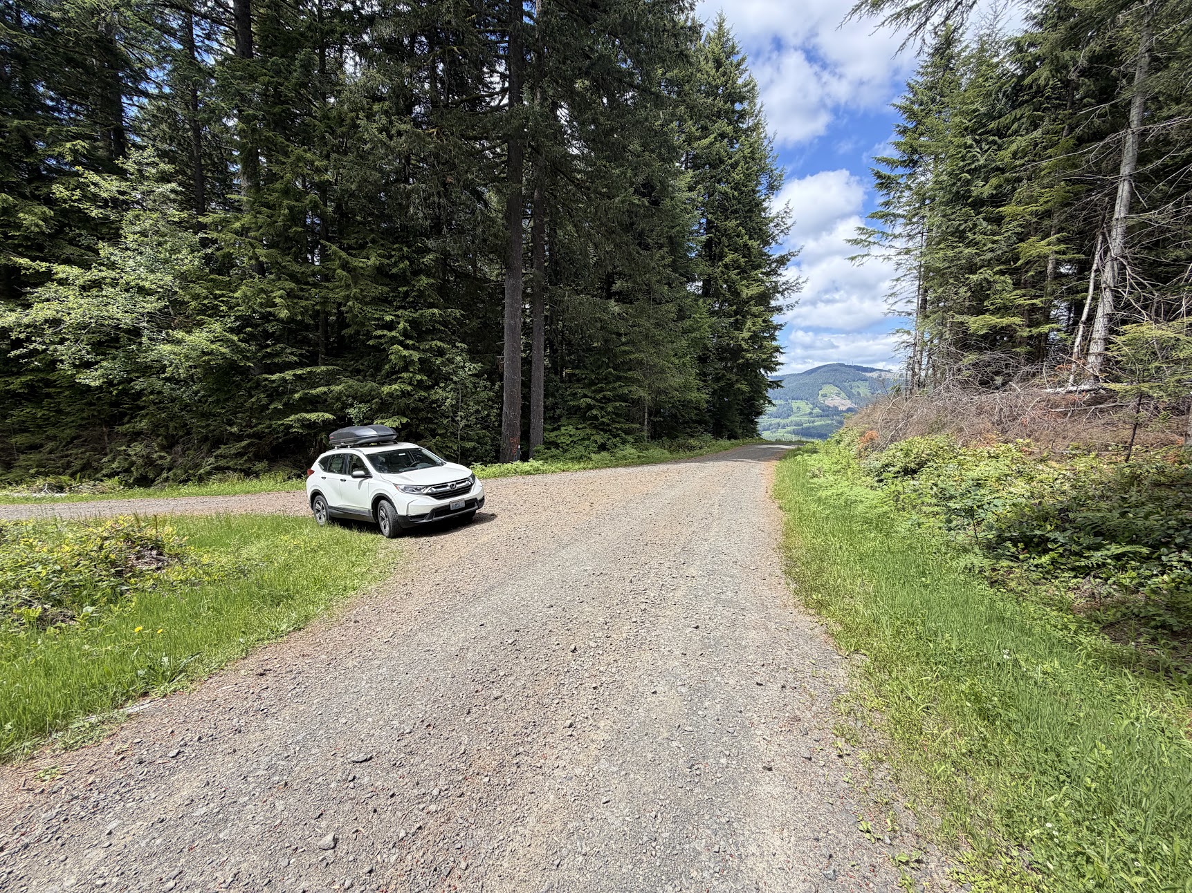
Getting There
This is a pretty easy drive-up summit for most cars, although it gets a little steep and narrow at times so AWD and a little clearance doesn't hurt.
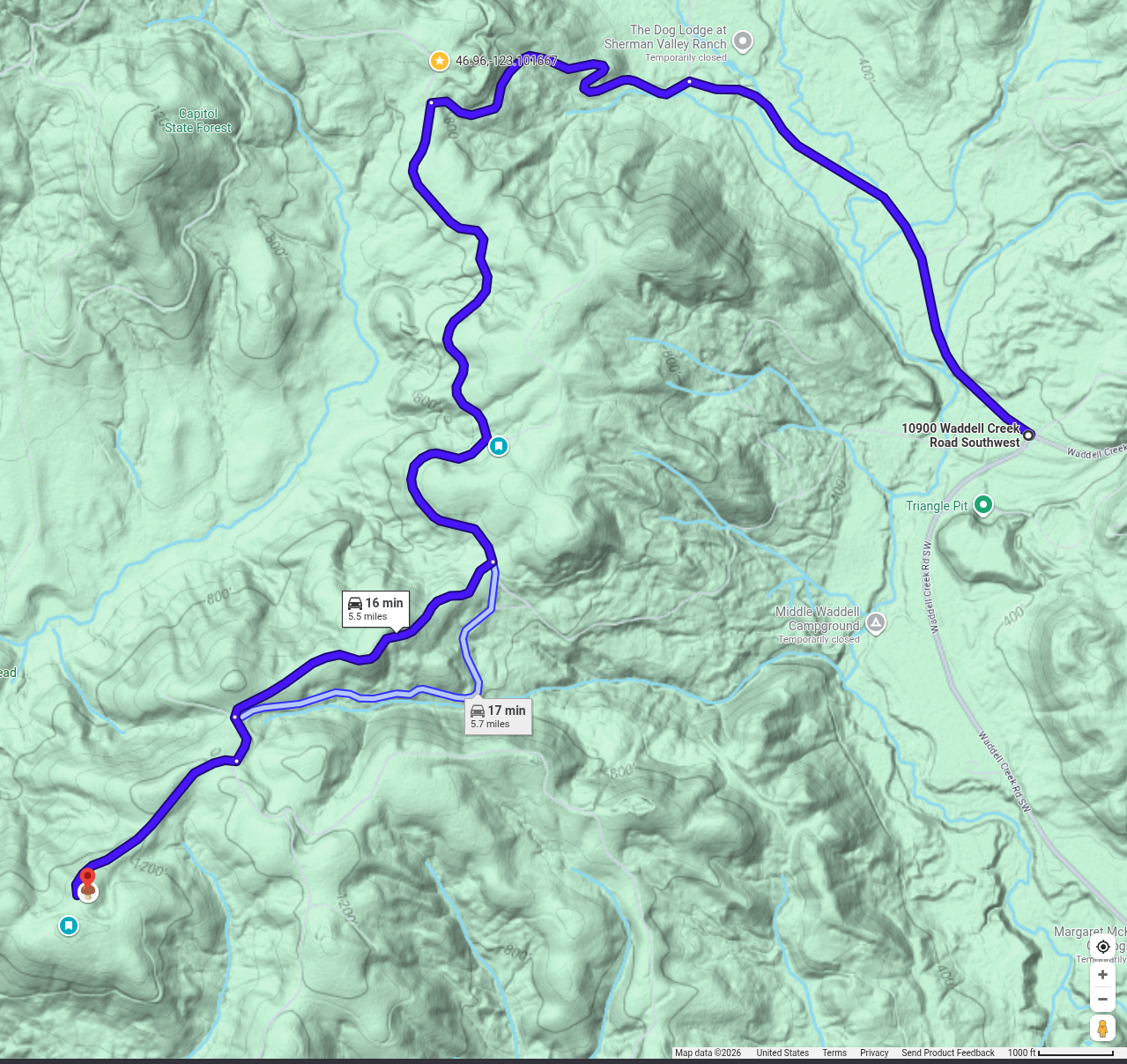
Google Maps directions that have you entering from the north (Sherman Valley Road) have been correct on several visits. I can't speak to the directions Google gives from the south.
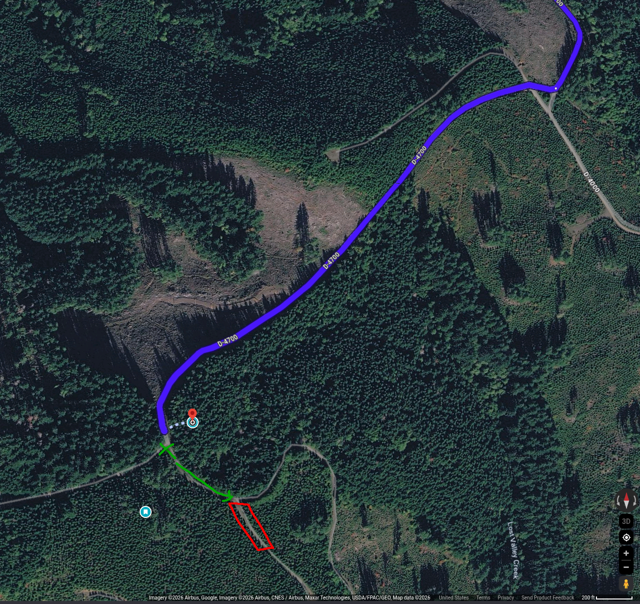
In the attached picture, I've parked at the green X and walked up hill 200-300 feet and turned right at the Y in the road, which brings you into the activation zone.
The true summit is buried deep in the brush and not easily accessible, but you can easily operate from the road in the AZ.
Watch out for ATVs and dirt bikes along the road to get here during the warmer months.
Antennas
There are a lot of tall trees to hang a wire from, no problem. The ground is a little too hard to stake anything (like a vertical) in. The summit is also a bit low and flat with some obstructions, making VHF operation more difficult. If you could raise your VHF antenna up a bit, I think you'd do ok, but I've only made one 2m contact from here.
Other
There is no real view from the summit itself, but there is a nice view facing north with what I believe is Capitol Peak in sight. In theory, W7W/SO-067 and W7W/SO-73 should be RF line-of-site, if you wanted to schedule a S2S.