This is a correct trip report for SO-103. The first activation report posted for SO-103 in 2015 is really for SO-104 which is located in the Capital Forest and is also named “1380”, it appears the activator accidentally switched the summit references.
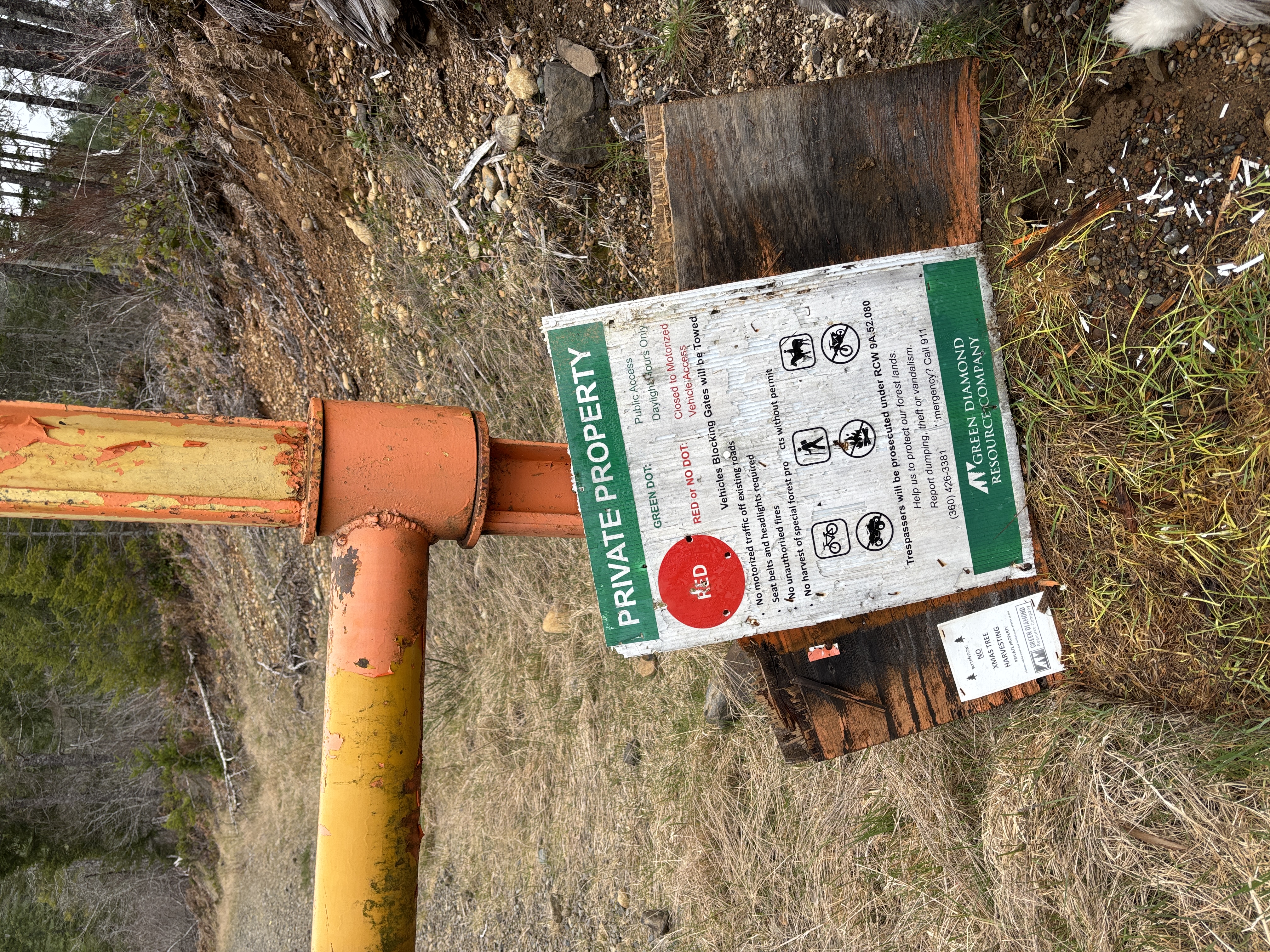
Access to SO-103 is via Green Diamond land. Non-motorized access is permitted (see photo). The gate is located right off NF-23 which is paved all the way to the parking location at 47.34052, -123.31383. Google maps routed me with no issues.
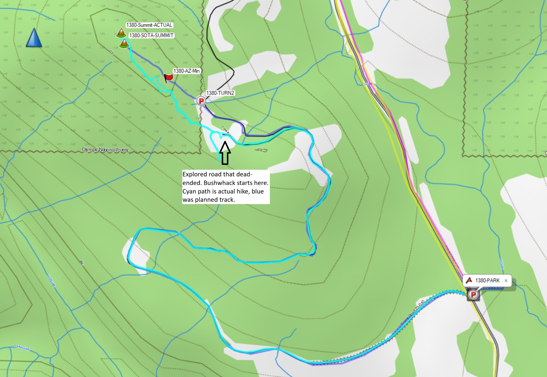
The hike is a combination of 1.8 mile road hike and moderate 0.3 mile bushwhack. Elevation gain is 780 feet. You exit the road and start the bushwhack at 47.34558, -123.32466, it is pretty straightforward to follow the ridgeline to the summit. I found that the “true” summit is a bit farther up then the SOTA Summit coordinates. There is underbrush about knee high and signs of lots of thinning along the bushwhack. The summit is in the Olympic National Forest so this summit could be a combo-SOTA-POTA activation.
Operating with a wire antenna was a bit challenging with lots of trees around and not too many clearings. I’d recommend a vertical antenna if you have one. There was ATT cell coverage to enable spotting.
GPX track of my hike is posted to SOTA mapping site, as well as below.