NOTE: This route is only available during ski operations of Mt Bachelor Resort. The Summit Chair ski lift only runs during winter and spring ski operations.
Mount Bachelor offers one of the easiest 10-pointers in Oregon, if you want it. It is possible to buy a lift ticket and take the Summit Chair ski lift nearly to the activation zone. It is only a short hike to the summit proper from the top of the lift.
Activation Reports

Submitted by N7KOM on
Summit:

Submitted by KB7ZOG on
Summit:
Thomas Cairn is a 4321 ft peak located 0.6 miles northeast of it's better known sister Snow Peak (4292ft) in Linn County, Oregon. The peaks are 14.3 miles east of the town of Scio. This summit could be accessed entirely on public lands (BLM) but it would be extremely difficult and treacherous when there is snow on the ground. This attempt was completed using a combination of BLM and private lands. The 7.0 mile round trip hike featured 1325 feet of elevation gain and was mostly done on BLM-access roads, jeep trails, logging roads and a bit of bushwacking.

Submitted by KX7SAR on
Summit:
Anderson Butte is a beautiful, year-round hike with incredible views of higher peaks throughout the Siskiyou, Coast, and Northern California ranges. There are multiple parking/trailhead options with access to both the peak and the Jack-Ash trailsystem connecting the Applegate Valley, Jacksonville, and Ashland.

Submitted by AE7AP on
Summit:
0.5 miles; + 687 feet
This is a pleasant hike that begins at the historic Greenstone Mine just west of Apex, MT in the foothills of the East Pioneer Mountains.
Submitted by N7KOM on
Summit:
First the TL;DR: This is a five star bike ride. I HIGHLY recommend this route. This route passes many different trailheads and parking areas along the Deschutes River, so it is possible to put together a ride that is shorter and easier. Much of the route is gradual uphill with Lava Butte itself being the real kicker.
Submitted by KB7ZOG on
Summit:
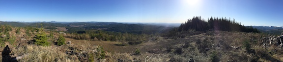
This first time activation was done entirely upon private property. Written permission from the property owner was obtained prior to the attempt. Any subsequent attempts must granted prior written permission. Franklin Butte WV-097 is a 909ft peak located 2.5 miles south of the town of Scio, Oregon. The 2.5 mile round trip hike features 1 mile on a powerline access grass road and 1.5 miles of bushwacking to the summit along a ridgetop. The elevation gain is about 550 feet.
Driving Directions -


Submitted by WU7H on
Summit:
Git Out Ridge is a a 2 point summit located about 5 miles north of Gold Bar. The 6.8 mile (roundtrip) hike begins at Spada Lake and is mostly a walk on a gravel road. About 1/3 of the hike is on an abandoned section of road that goes through the forest. Total elevation gain is ~1300'.
Driving Directions:
Take Highway 2 to Sultan. Take the Sultan Basin Road north. Most of the way is paved, but the last 1/3 of the road is gravel. We went in a Prius and had no trouble - the gravel road is in good shape. Keep following the road until you arrive at Spada Lake Dam.
Submitted by N7KOM on
Summit:
DIRECTIONS NOTE: Google Maps may try to send you on "Rd 20" off of HWY 26. Unfortunately the bridge that crosses Still Creek is CLOSED. Take Still Creek Rd, off of HWY 26.
For the 2021 Willamette Valley S2S party I wanted something that would get my heart rate up and I finally settled on Devil's Peak (W7O/CN-033). After a detour in Rhodedendron (see above), I parked at the trailhead and started up. That's what this trail does. It goes up.

Submitted by K7EEX on
Summit:
Looking over the map and seeing a named peak with no activations is just more than I can handle, especially when K7ATN's blog post left the slightest hope that there may be a way to get there. After hours of poring over maps, I came up with a plan.